
File:RUS-2016-Aerial-SPB-Tauride Palace (crop).jpg
Size of this preview: 800 × 514 pixels. Other resolutions: 320 × 205 pixels | 640 × 411 pixels | 1,024 × 658 pixels | 1,280 × 822 pixels | 2,560 × 1,644 pixels | 4,896 × 3,144 pixels.
Original file (4,896 × 3,144 pixels, file size: 11.98 MB, MIME type: image/jpeg)
.jpg)
Summary
| Description |
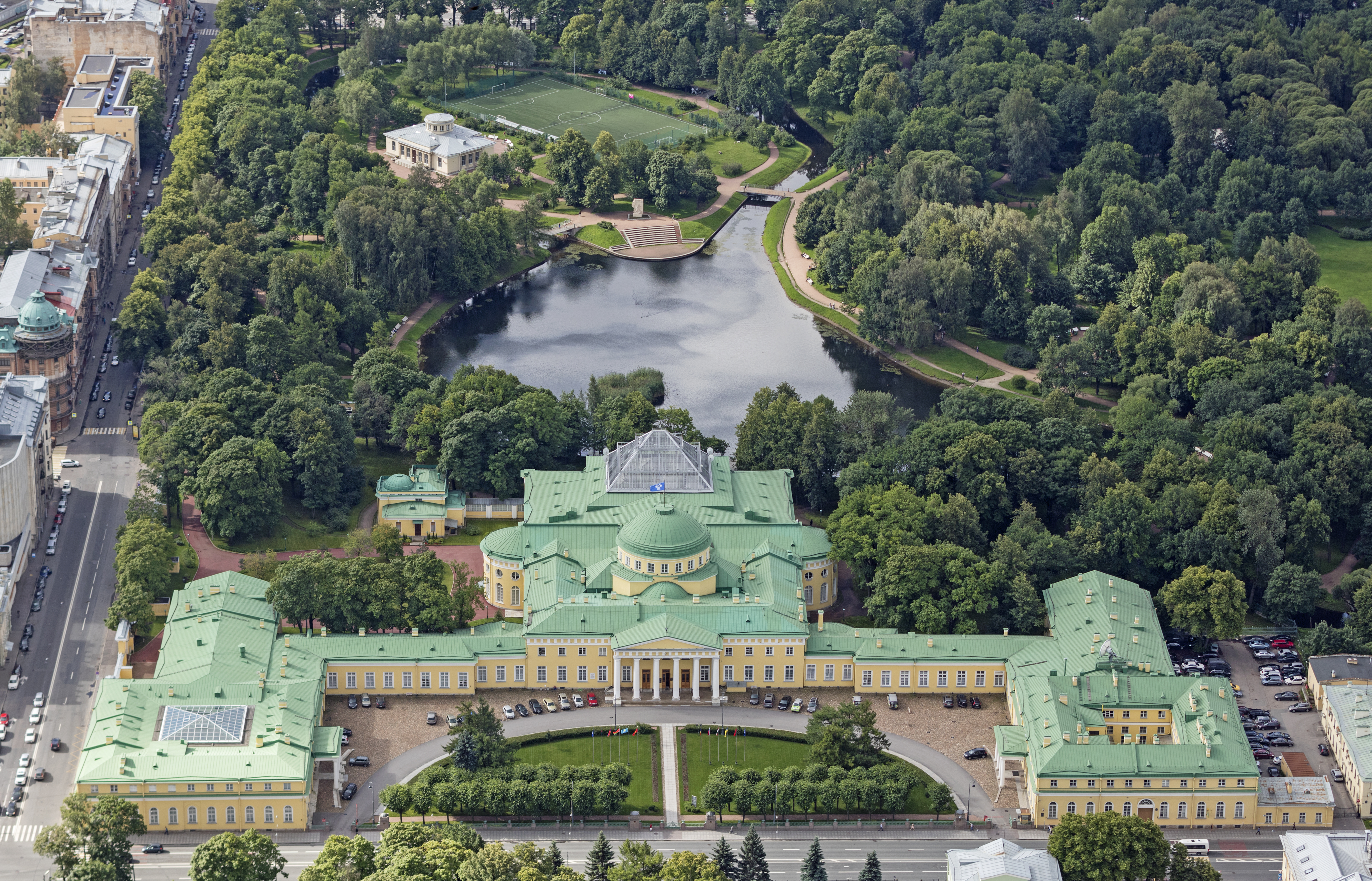
Italiano: Foto aerea del Palazzo di Tauride, uno di più grandi ed importanti palazzi di San Pietroburgo.
|
| Date | |
| Source | Own work |
| Author | Godot13 |
| Other versions |
 |
| Attribution (required by the license) | Andrew Shiva / Wikipedia / |
| Camera location | | View this and other nearby images on: OpenStreetMap |
|---|
.jpg¶ms=059.957423_N_0030.395913_E_globe:Earth_type:camera__&language=en)
Assessment
|
.jpg)
.jpg)
This image was selected as picture of the day on Wikimedia Commons for 27 February 2018. It was captioned as follows: Other languages:
Italiano: Foto aerea del Palazzo di Tauride, uno di più grandi ed importanti palazzi di San Pietroburgo. |

|
This image has been assessed under the valued image criteria and is considered the most valued image on Commons within the scope: Tauride Palace (aerial). You can see its nomination here. |
.jpg)
Licensing
I, the copyright holder of this work, hereby publish it under the following license:
This file is licensed under the Creative Commons Attribution-Share Alike 4.0 International license.
- You are free:
- to share – to copy, distribute and transmit the work
- to remix – to adapt the work
- Under the following conditions:
- attribution – You must give appropriate credit, provide a link to the license, and indicate if changes were made. You may do so in any reasonable manner, but not in any way that suggests the licensor endorses you or your use.
- share alike – If you remix, transform, or build upon the material, you must distribute your contributions under the same or compatible license as the original.

|
The copyright holder of this file, Andrew Shiva, allows anyone to use it for any purpose, provided that the copyright holder is properly attributed. Redistribution, derivative work, commercial use, and all other use is permitted. |
Attribution:
Use or reproduction of this image outside of Wikipedia must give the original photographer (Andrew Shiva) credit. Although not required, it would be appreciated if a message was left here indicating where this image was being used.
|
File history
Click on a date/time to view the file as it appeared at that time.
| Date/Time | Thumbnail | Dimensions | User | Comment | |
|---|---|---|---|---|---|
| current | 04:40, 1 October 2016 | | 4,896 × 3,144 (11.98 MB) | Godot13 | User created page with UploadWizard |
File usage
There are no pages that use this file.
.jpg)