
File:Flooded Albizia Saman (rain tree) in the Mekong.jpg
Size of this preview: 800 × 533 pixels. Other resolutions: 320 × 213 pixels | 640 × 427 pixels | 1,024 × 683 pixels | 1,280 × 853 pixels | 2,560 × 1,707 pixels | 6,720 × 4,480 pixels.
Original file (6,720 × 4,480 pixels, file size: 15.4 MB, MIME type: image/jpeg)
Summary
| Description |
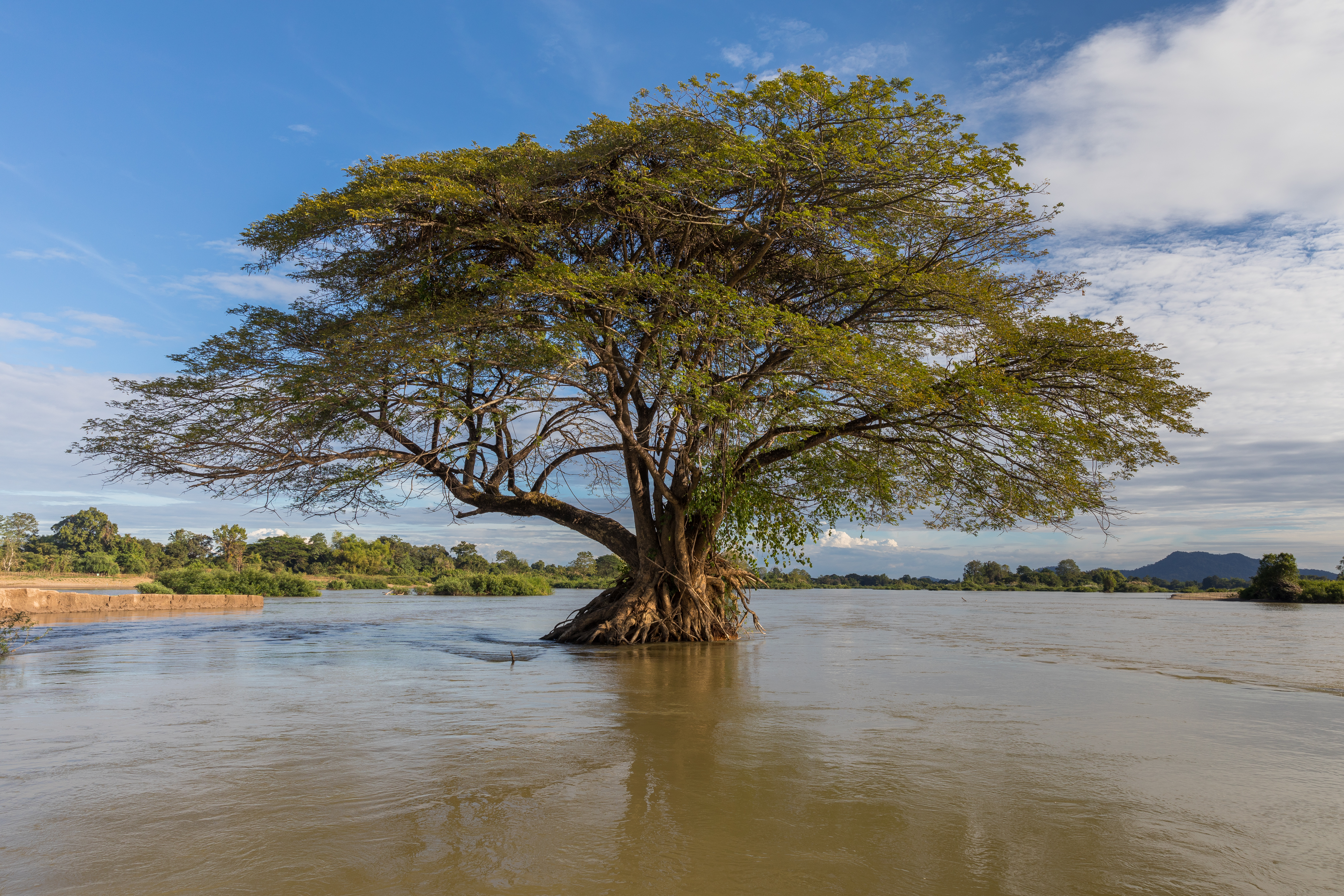
English: Submerged Samanea saman (Albizia saman or rain tree) in the Mekong, near the island of Don Loppadi, Laos, during the dry season (when the river is low), in the afternoon at 4:00 pm
Español: Árbol de la lluvia (Samanea saman) parcialmente sumergido en el río Mekong, cerca de la isla de Don Loppadi, Laos, durante la estación seca (cuando el río está bajo).
Français : Samanea saman (Albizia saman ou arbre à pluie) immergé dans le Mékong, près de l'île de Don Loppadi, au Laos, pendant la saison sèche (quand le fleuve est bas), l'après-midi à 16 heures
Українська: Затоплене Samanea saman (Albizia saman або дощове дерево) у Меконгу, недалеко від острова Дон Лоппаді, Лаос, у сухий сезон (коли річка маловодна).
中文:一部份浸入湄公河的雨树,拍摄于旱季(河流水位低)的四千岛的Don Loppadi |
| Date | |
| Source | Own work |
| Author | Basile Morin |
| Other versions |
|

.jpg)
| Camera location | | View this and other nearby images on: OpenStreetMap |
|---|
Assessment
|

_in_the_Mekong.jpg)
_in_the_Mekong.jpg¶ms=014.016300_N_0105.859233_E_globe:Earth_type:camera__&language=en)
_in_the_Mekong.jpg)
This image was selected as picture of the day on Wikimedia Commons for 28 December 2022. It was captioned as follows: English: Partially submerged Samanea saman (Albizia saman or rain tree) in the Mekong, near the island of Don Loppadi, Laos, during the dry season (when the river is low) Other languages:
Čeština: Tropický strom z rodu saman Samanea saman rostoucí v řece Mekong poblíž ostrova Don Loppadi v Laosu během období sucha, kdy je v řece nízký stav vody. Deutsch: Überschwemmter Regenbaum (Albizia saman) im Mekong, in der Nähe der Insel Don-Loppadi, Laos, während der Trockenzeit. English: Partially submerged Samanea saman (Albizia saman or rain tree) in the Mekong, near the island of Don Loppadi, Laos, during the dry season (when the river is low) Español: Árbol de la lluvia (Samanea saman) parcialmente sumergido en el río Mekong, cerca de la isla de Don Loppadi, Laos, durante la estación seca (cuando el río está bajo). Français : Un arbre à pluie (Samanea saman) partiellement immergé dans les eaux du Mékong au Laos, pendant la saison sèche. Magyar: Vízbe merült sámánfa (Albizia saman) a Mekong folyóban, száraz évszakban, a folyó alacsony vízállásánál, Don Loppadi szigete közelében (Laosz) Português: Árvore da chuva (Samanea saman) parcialmente submersa no rio Mecom, perto da ilha Don Loppadi, Laos, durante a estação seca (quando o nível do rio está baixo). Slovenščina: Delno potopljeno deževno drevo (Samanea saman ali Albizia saman) v Mekongu, blizu otoka Don Loppadi, Laos, v sušnem obdobju (ko je gladine reke nizka) Українська: Затоплене Samanea saman (Albizia saman або дощове дерево) у Меконгу, недалеко від острова Дон Лоппаді, Лаос, у сухий сезон (коли річка маловодна). 中文: 一部份浸入湄公河的雨树,拍摄于旱季(河流水位低)的四千岛的Don Loppadi 中文(繁體): 一部份浸入湄公河的雨樹,拍攝於旱季(河流水位低)的四千島的Don Loppadi |
Licensing
I, the copyright holder of this work, hereby publish it under the following license:
This file is licensed under the Creative Commons Attribution-Share Alike 4.0 International license.
- You are free:
- to share – to copy, distribute and transmit the work
- to remix – to adapt the work
- Under the following conditions:
- attribution – You must give appropriate credit, provide a link to the license, and indicate if changes were made. You may do so in any reasonable manner, but not in any way that suggests the licensor endorses you or your use.
- share alike – If you remix, transform, or build upon the material, you must distribute your contributions under the same or compatible license as the original.
File history
Click on a date/time to view the file as it appeared at that time.
| Date/Time | Thumbnail | Dimensions | User | Comment | |
|---|---|---|---|---|---|
| current | 11:18, 1 January 2018 | | 6,720 × 4,480 (15.4 MB) | Basile Morin | User created page with UploadWizard |
File usage
There are no pages that use this file.
_in_the_Mekong.jpg)